This Page Hyperlinked [click on] Mount Baker Stratovolcano (background)© ™ ®/ Kulshan Stratovolcano© ™ ®, Simon Fraser University (foreground)© ™ ® ~ Image by Stan G. Webb - In Retirement© ™ ®, An Intelligent Grandfather's Guides© ™ ® next, The Man From Minto© ™ ® - A Prospector Who Knows His Rocks And Stuff© ™ ®
Learn more about the Cascadia Volcanic Arc© ™ ® (Part of Pacific Ring of Fire) Cascadia Volcanoes© ™ ® and the currently active Mount Meager Massif© ™ ®, part of the Cascadia Volcanic Arc© ™ ® [ash flow, debris flows, fumaroles and hot springs], just northwest of Pemberton and Whistler, Canada ~ My personal interest in the Mount Meager Massif© is that the last volcanic vent blew north, into the Bridge River Valley [The Bridge River Valley Community Association (BRVCA), [formerly Bridge River Valley Economic Development Society], near my hometown. I am the Man From Minto© ™ ® - A Prospector Who Knows His Rocks And Stuff© ™ ® The 2010 Mount Meager landslide was a large catastrophic debris avalanche that flowed to the south, into the Lillooet Valley British Columbia, Canada, on August 6 at 3:27 a.m. PDT (UTC-7). More than 45,000,000 m3 (1.6×10⁹ cu ft) of debris slid down Mount Meager, temporarily blocking Meager Creek and destroying local bridges, roads and equipment. It was one of the largest landslides in Canadian history and one of over 20 landslides to have occurred from the Mount Meager massif in the last 10,000 years. Although voluminous, there were no fatalities caused by the event due in part to its remote and uninhabited location. The landslide was large enough to send seismic waves more than 2,000 km (1,200 mi) away into the neighbouring U.S. states of Alaska and Washington and beyond. Multiple factors led to the slide: Mount Meager's weak slopes have left it in a constant state of instability. The massif has been a source of large volcanic debris flows for the last 8,000 years, many of which have reached several tens of kilometres downstream in the Lillooet River valley.[6], to the south. It is arguably the most unstable mountain massif in Canada and may also be its most active landslide area.[6][1] And on the north side lies Downton Lake Hydro Reservoir, impounded by the La Joi Dam, the uppermost of the Bridge River Project dams. The earliest identified Holocene landslide was in 7900 BP (before the present, or read it as the number of years ago). Further landslides occurred in 6250 BP, 5250 BP, 4400 BP, 2600 BP, 2400 BP, 2240. BP BP, 2170 BP, 1920 BP, 1860 BP, 870 BP, 800 BP, 630 BP, 370 BP, 210 BP, 150 BP and in 1931, 1947, 1972, 1975, 1984, 1986 and 1998.[6] These events were attributed to structurally weak volcanic rocks, glacial unloading, recent explosive volcanism and Little Ice Age glacial activity.[1] Those who dance with earthquakes and volcanoes are considered mad by those who cannot smell the sulfur. We begin to deal with BIG (MEGA) EARTHQUAKES at Simon Fraser University (foreground) Kulshan Stratovolcano© / Mount Baker Stratovolcano (background)©New Cascadia Dawn© - Cascadia Rising - M9 to M10+, An Intelligent Grandfather's Guide© next, ~ Images by Stan G. Webb - In Retirement©, An Intelligent Grandfather's Guides©

Countdown to next earthquake drill at 10:17AM, Saturday, October 17, 2022

Get vaccinated. Wear a mask. Save lives. Be Proud of Our Truckers

Friday, January 15, 2021

Chilkat Crisis: A Calling to Vitalize Indigenous Knowledge Foundations w...

Breaking Dawn


To share your feedback on our lecture series, please go ahead and fill out a short survey: https://www.surveymonkey.com/r/SHILec... Northwest Coast Art Lecture Series. For more information visit: https://www.sealaskaheritage.org/node... Learn more about Sealaska Heritage here: https://www.sealaskaheritage.org/ https://www.facebook.com/SHInstitute/ https://www.instagram.com/shinstitute/ https://twitter.com/SHInstitute


Reference:

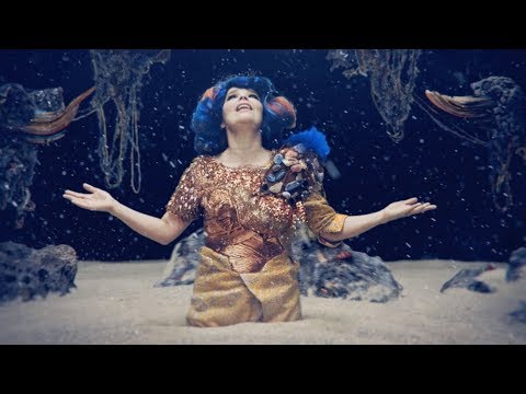
Chilkat Crisis: A Calling to Vitalize Indigenous Knowledge Foundations with Tlingit Weaver Lily Hope

https://youtu.be/1I3wjJ9iZJ4 [59:30 minutes

Sealaska Heritage Institute

To share your feedback on our lecture series, please go ahead and fill out a short survey: https://www.surveymonkey.com/r/SHILec... Northwest Coast Art Lecture Series. For more information visit: https://www.sealaskaheritage.org/node... Learn more about Sealaska Heritage here: https://www.sealaskaheritage.org/ https://www.facebook.com/SHInstitute/ https://www.instagram.com/shinstitute/ https://twitter.com/SHInstitute


From Wikipedia, the free encyclopedia

(Redirected from Chilkat Tlingit)

The Tlingit (/ˈklɪŋkɪt/ or /ˈtlɪŋɡɪt/; also spelled Tlinkit; Russian: Тлинкиты) are indigenous peoples of the Pacific Northwest Coast of North America.[2] Their language is the Tlingit language (natively Lingít, pronounced [ɬɪ̀nkɪ́tʰ]),[3] in which the name means "People of the Tides".[4] The Russian name Koloshi (Колоши, from a Sugpiaq-Alutiiq term kulut'ruaq for the labret worn by women) or the related German name Koulischen may be encountered referring to the people in older historical literature, such as Shelikhov's 1796 map of Russian America.[5]

The Tlingit have a matrilineal kinship system, with children considered born into the mother's clan, and property and hereditary roles passing through the mother's line.[6] Their culture and society developed in the temperate rainforest of the southeast Alaska coast and the Alexander Archipelago. The Tlingit maintained a complex hunter-gatherer culture based on semi-sedentary management of fisheries.[7] An inland group, known as the Inland Tlingit, inhabits the far northwestern part of the province of British Columbia and the southern Yukon Territory in Canada.


No comments:

Post a Comment

björk : mutual core

björk : mutual core https://youtu.be/-WnzRqCK6Fs [5:14 minutes] By Iceland native björk 605K subscribers 764,843 v...